GeoSentinel AI
Autonomous Sentinel-2 satellite imagery acquisition pipeline and geospatial analytics platform. Integrates Anthropic Claude 3.5 Sonnet Vision for multimodal raster interpretation, automated cloud-mask validation, environmental index calculation, and zero-shot ecological anomaly reporting.
Challenge & Context
Accessing raw ESA Copernicus satellite data was hindered by multi-gigabyte ZIP downloads, manual cloud masking, and complex radiometric calibrations. Environmental monitoring teams lacked automated NDVI telemetry pipelines and multimodal intelligence to interpret rapid changes.
Engineering Execution
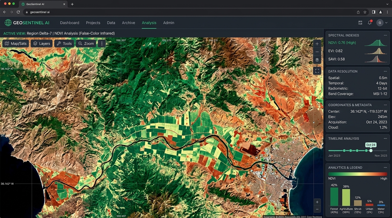
Engineered an end-to-end ingestion pipeline decoupling raster downloads from cloud detection inference. We designed a clean radar dashboard featuring vector-rendered heatmaps, spectral band combinations, and automated Anthropic Claude multimodal inspection for zero-shot environmental change detection and disaster monitoring.
DESIGN & ENGINEERING EXECUTION
Minimalist radar-style dashboard with high-contrast false-color infrared overlays. Interactive geospatial polygon selection with real-time histogram distribution for vegetation index tracking and prompt-driven spatial exploration.
FastAPI microservices communicating with Python rasterio/GDAL workers, integrated with React 19, Leaflet WebGL canvas tile layers, and Anthropic Claude 3.5 Sonnet Vision via the Anthropic Claude API. Multispectral tiles are analyzed for flood extent estimation, deforestation telemetry, and natural-language geospatial querying.
MEASURABLE OUTCOME
TECHNOLOGIES LEVERAGED:
VISUAL ARTIFACTS
This system was architected under our Capabilities & Services matrix. Exploring custom web development in Northeast India? View our Guwahati Web Design Studio or explore Rajat Pradhan’s Full Engineering Portfolio.